You can
sponsor
this page
Common name (e.g. trout)
contains
begins with
begins with
ends with
is
Genus + Species (e.g. Gadus morhua)
关于本页
More Info
Plus d'info
Mais info
语言
Arabic
Bahasa/Malay
Bangla
Chinese(Si)
Chinese(Tr)
Deutsch
English
Español
Farsi
Français
Greek
Hindi
Italiano
Japanese
Lao
Nederlands
Português(Br)
Português(Pt)
Russian
Swedish
Thai
Vietnamese
User feedbacks
Comments &
Corrections
鱼类讨论区
留言版
Facebook
引用出处
Uploads
附加相关网站
上传图片
上传影像
Upload
references
Fish Watcher
相关物种
物种在
Nemadactylus
物种在
Latridae
- 分类 -
Latridae
Centrarchiformes
Teleostei
Chordata
Animalia
Nemadactylus
macropterus
(Forster
, 1801)
Tarakihi
添加你自己的观测位置在
Fish Watcher
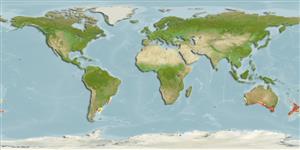
Native range
|
All suitable habitat
|
Point map
|
Year 2050
This map was computer-generated and has not yet been reviewed.
Nemadactylus macropterus
AquaMaps
Data sources:
GBIF
OBIS
上传你的
图片
和
影像
Pictures
|
谷歌图片
Nemadactylus macropterus
Picture by
SeaFIC
New Zealand country information
Common names:
Tarakihi
,
Tarakihi
Occurrence:
native
Salinity:
marine
Abundance:
common (usually seen)
|
Ref:
Armitage, R.O., D.A. Payne, G.J. Lockley, H.M. Currie, R.L. Colban, B.G. Lamb and L.J. Paul (eds.), 1994
Importance:
commercial
|
Ref:
Armitage, R.O., D.A. Payne, G.J. Lockley, H.M. Currie, R.L. Colban, B.G. Lamb and L.J. Paul (eds.), 1994
Aquaculture:
|
Ref:
Regulations:
|
Ref:
Uses:
gamefish: yes;
Comments:
Common throughout New Zealand, but most abundant in the cooler waters south of East Cape and around the South Island (Ref. 9258), and south to Snares Island (Ref. 115198). Recorded from Northeastern and Eastern Chatham Rise as rarely found (Ref. 87166). Landed throughout the year with catches increasing from February to June (Ref. 9258). Recorded in trawl surveys in Chatham Islands (Ref. 45493) and off the east coast of South Island (Ref. 58461). Voucher specimen(s) held at the NMNZ. See Ref. 9072 for use in game fishing. Also Ref. 5873, 8879, 45524, 75154.
National Checklist:
Country Information:
https://www.cia.gov/library/publications/resources/the-world-factbook/geos/nz.html
National Fisheries Authority:
http://www.fish.govt.nz/
Occurrences:
Occurrences
Point map
Main Ref:
Paulin, C., A. Stewart, C. Roberts and P. McMillan, 1989
National Database:
Common names from other countries
Джакас серый
,
Jackass morwong
,
长鳍线指
,
... more
分类 / Names
俗名
|
同种异名
| Catalog of Fishes(
属
,
种
) |
ITIS
|
CoL
|
WoRMS
|
Cloffa
Teleostei >
Centrarchiformes
(Basses) >
Latridae
(Trumpeters)
Etymology:
Nemadactylus:
Greek, nema, -atos = filament + Greek, daktylos = finger (Ref.
45335
)
.
More on author:
Forster
.
Environment: milieu / climate zone / depth range / distribution range
生态学
海洋
居于水底的;
深度上下限
22 - 450 m (Ref.
58489
), usually 100 - 250 m (Ref.
3243
). 亞熱帶的; 27°S - 48°S, 62°W - 176°W
分布
国家
|
FAO区域
|
生态系
|
标本纪录
|
Fatal error
: Uncaught mysqli_sql_exception: Table 'fbapp.scientificname' doesn't exist in /var/www/html/includes/speciessummary.lib.php:2366 Stack trace: #0 /var/www/html/includes/speciessummary.lib.php(2366): mysqli->query() #1 /var/www/html/country/CountrySpeciesSummary.php(1228): checkPointMApDisplay() #2 {main} thrown in
/var/www/html/includes/speciessummary.lib.php
on line
2366


")