You can
sponsor
this page
Common name (e.g. trout)
contains
begins with
begins with
ends with
is
Genus + Species (e.g. Gadus morhua)
About this page
More Info
Plus d'info
Mais info
Languages
Arabic
Bahasa/Malay
Bangla
Chinese(Si)
Chinese(Tr)
Deutsch
English
Español
Farsi
Français
Greek
Hindi
Italiano
Japanese
Lao
Nederlands
Português(Br)
Português(Pt)
Russian
Swedish
Thai
Vietnamese
User feedbacks
Comments &
Corrections
Fish Forum
Guest Book
Facebook
Citation
Uploads
Attach website
Upload photo
Upload video
Upload
references
Fish Watcher
Related species
Hyperoglyphe antarctica
Species in
Hyperoglyphe
Species in
Centrolophidae
- Classification -
Centrolophidae
Scombriformes
Teleostei
Chordata
Animalia
Hyperoglyphe
antarctica
(Carmichael
, 1819)
Bluenose warehou
Add your observation in
Fish Watcher
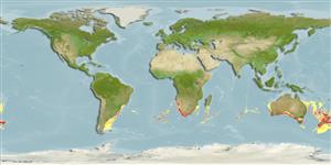
Native range
|
All suitable habitat
|
Point map
|
Year 2050
This map was computer-generated and has not yet been reviewed.
Hyperoglyphe antarctica
AquaMaps
Data sources:
GBIF
OBIS
Upload your
photos
and
videos
Pictures
|
Google image
Hyperoglyphe antarctica
Picture by
SeaFIC
Norfolk Island country information
Common names:
[No common name]
Occurrence:
native
Salinity:
marine
Abundance:
|
Ref:
Importance:
|
Ref:
Aquaculture:
|
Ref:
Regulations:
|
Ref:
Uses:
no uses
Comments:
National Checklist:
Country Information:
https://www.cia.gov/library/publications/resources/the-world-factbook/geos/nf.html
National Fisheries Authority:
Occurrences:
Occurrences
Point map
Main Ref:
Kailola, P.J., M.J. Williams, P.C. Stewart, R.E. Reichelt, A. McNee and C. Grieve, 1993
National Database:
Common names from other countries
Rouffe antarctique
,
Rufo antártico
,
خزّان مَزرورق
,
... more
Classification / Names
Common names
|
Synonyms
| Catalog of Fishes(
genus
,
species
) |
ITIS
|
CoL
|
WoRMS
|
Cloffa
Teleostei (teleosts) >
Scombriformes
(Mackerels) >
Centrolophidae
(Medusafishes)
Etymology:
Hyperoglyphe:
Greek, hyper = over + Greek, glyphis = carved (Ref.
45335
)
.
Environment: milieu / climate zone / depth range / distribution range
Ecology
Marine; benthopelagic; depth range 40 - 1500 m (Ref.
52180
), usually 260 - 490 m (Ref.
52180
). Deep-water; 19°S - 55°S, 67°W - 173°W
Distribution
Countries
|
FAO areas
|
Ecosystems
|
Occurrences
|
Fatal error
: Uncaught mysqli_sql_exception: Table 'fbapp.scientificname' doesn't exist in /var/www/html/includes/speciessummary.lib.php:2366 Stack trace: #0 /var/www/html/includes/speciessummary.lib.php(2366): mysqli->query() #1 /var/www/html/country/CountrySpeciesSummary.php(1228): checkPointMApDisplay() #2 {main} thrown in
/var/www/html/includes/speciessummary.lib.php
on line
2366

")
