You can
sponsor
this page
Common name (e.g. trout)
contains
begins with
begins with
ends with
is
Genus + Species (e.g. Gadus morhua)
About this page
More Info
Plus d'info
Mais info
Languages
Arabic
Bahasa/Malay
Bangla
Chinese(Si)
Chinese(Tr)
Deutsch
English
Español
Farsi
Français
Greek
Hindi
Italiano
Japanese
Lao
Nederlands
Português(Br)
Português(Pt)
Russian
Swedish
Thai
Vietnamese
User feedbacks
Comments &
Corrections
Fiskforum
Gästbok
Facebook
Referens
Uploads
Attach website
Upload photo
Upload video
Upload
references
Fish Watcher
Related species
Species in
Eretmichthys
Species in
Ophidiidae
- Classification -
Neobythitinae
Ophidiidae
Ophidiiformes
Teleostei
Chordata
Animalia
Eretmichthys
pinnatus
Garman
, 1899
Add your observation in
Fish Watcher
Native range
|
All suitable habitat
|
Point map
|
Year 2050
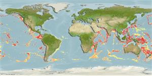
This map was computer-generated and has not yet been reviewed.
Eretmichthys pinnatus
AquaMaps
Data sources:
GBIF
OBIS
Upload your
photos
and
videos
Pictures
|
Google image
Eretmichthys pinnatus
Picture by
FAO
Japan country information
Common names:
Furisode-ashiro
Occurrence:
native
Salinity:
marine
Abundance:
|
Ref:
Importance:
|
Ref:
Aquaculture:
|
Ref:
Regulations:
|
Ref:
Uses:
no uses
Comments:
Recorded off Japan at depths from about 1, 400 to 2, 000 m (Ref. 31399). Museum: Kumano basin, east of Mie Prefecture, Japan, ORIUT 8606-06-0100 (male, 3.86 SL) (Ref. 31399).
National Checklist:
Country Information:
https://www.cia.gov/library/publications/resources/the-world-factbook/geos/ja.html
National Fisheries Authority:
http://www.maff.go.jp/eindex.html
Occurrences:
Occurrences
Point map
Main Ref:
Machida, Y. and S. Ohta, 1990
National Database:
Common names from other countries
Furisode-ashiro
,
凹鳍桨鼬鳚
,
凹鰭槳鼬鳚
,
... more
Classification / Names
Populärnamn
|
synonymer
| Catalog of Fishes(
Släkte
,
Arter
) |
ITIS
|
CoL
|
WoRMS
|
Cloffa
>
Ophidiiformes
(Cusk eels) >
Ophidiidae
(Cusk-eels) > Neobythitinae
Etymology:
Eretmichthys:
Greek, eretmos, -ou = with oars (Ref.
45335
)
.
More on author:
Garman
.
Environment: milieu / climate zone / depth range / distribution range
Ekologi
marina
djupbottenlevande;
djupintervall
1355 - 2820 m (Ref.
34024
). Deep-water
Utbredning
Länder
|
FAO områden
|
Ekosystem
|
Förekomster
|
Fatal error
: Uncaught mysqli_sql_exception: Table 'fbapp.scientificname' doesn't exist in /var/www/html/includes/speciessummary.lib.php:2366 Stack trace: #0 /var/www/html/includes/speciessummary.lib.php(2366): mysqli->query() #1 /var/www/html/country/CountrySpeciesSummary.php(1228): checkPointMApDisplay() #2 {main} thrown in
/var/www/html/includes/speciessummary.lib.php
on line
2366