Common names:
Geurape cabeung, Kerapu nenas, Lyre-tail cod
Occurrence:
native
Salinity:
marine
Abundance:
|
Ref:
Importance:
subsistence fisheries
|
Ref:
Aquaculture:
|
Ref:
Regulations:
|
Ref:
Uses:
live export: yes;
Comments:
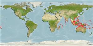
From Bali Strait to Timor Sea (Ref. 5978, 47567); including Flores (Ref. , 8631, 47567) and Mentawai Islands (Ref. 27157). Also recorded from Raja Ampat Islands, Manado and vicinity, Sangalakki Island, Togean and Banggai Islands and Pulau Weh; with an Indonesian distribution from Papua to Sumatra (Ref. 47567). Museum: RMNH 5461. Sumatera, Nias, NTM S.10771-002. Molucca Is., Ambon, BPBM 19219, 19321. NTM S.11038-001. Also Ref. 4787, 37816, 48635.
National Checklist:
Country Information:
https://www.cia.gov/library/publications/resources/the-world-factbook/geos/id.html
National Fisheries Authority:
Occurrences:
OccurrencesPoint map
Main Ref:
Heemstra, P.C. and J.E. Randall, 1993
National Database:
Environment: milieu / climate zone / depth range / distribution range
بوم شناسي
دريايي وابسته به آب سنگ; تغييرات عمق 4 - 200 m (Ref. 5222), usually 12 - 90 m (Ref. 37816). Tropical; 29°N - 26°S, 38°E - 171°W (Ref. 5222)
پراكنش
كشورها | مناطق سازمان خوار و بار جهاني (FAO) | Ecosystems | ظهور | Fatal error: Uncaught mysqli_sql_exception: Table 'fbapp.scientificname' doesn't exist in /var/www/html/includes/speciessummary.lib.php:2366
Stack trace:
#0 /var/www/html/includes/speciessummary.lib.php(2366): mysqli->query()
#1 /var/www/html/country/CountrySpeciesSummary.php(1228): checkPointMApDisplay()
#2 {main}
thrown in /var/www/html/includes/speciessummary.lib.php on line 2366

")
