Common names:
Labahita
Occurrence:
native
Salinity:
marine
Abundance:
|
Ref:
Importance:
|
Ref:
Aquaculture:
|
Ref:
Regulations:
|
Ref:
Uses:
live export: yes;
Comments:
Recorded from Bongo Island and Paril-Sangay Protected Seascape, Moro Gulf (Ref. 106380), Tañon Strait (Ref. 107276), Cebu, Mactan I., the east coast of Cebu near Huisan Point and Siquijor I. (Ref. 42056), Bantayan Is. in northern Cebu (Ref. 114734), Dauin-Apo I. (Ref. 127519), Batangas (San Luis, Bauan, Mabini, Lobo, San Juan) Batangas, between 3-7 m deep from Feb. - April 2014 (Ref. 107629). Also Ref. 37792, 53416, 121724.
National Checklist:
Country Information:
https://www.cia.gov/library/publications/resources/the-world-factbook/geos/rp.html
National Fisheries Authority:
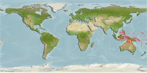
Occurrences:
OccurrencesPoint map
Main Ref:
Winterbottom, R., 1993
National Database:
Environment: milieu / climate zone / depth range / distribution range
بوم شناسي
دريايي وابسته به آب سنگ; تغييرات عمق 0 - 45 m (Ref. 42056), usually 3 - 25 m (Ref. 27115). Tropical; 24°C - 27°C (Ref. 27115); 15°N - 19°S, 111°E - 167°W
پراكنش
كشورها | مناطق سازمان خوار و بار جهاني (FAO) | Ecosystems | ظهور | Fatal error: Uncaught mysqli_sql_exception: Table 'fbapp.scientificname' doesn't exist in /var/www/html/includes/speciessummary.lib.php:2366
Stack trace:
#0 /var/www/html/includes/speciessummary.lib.php(2366): mysqli->query()
#1 /var/www/html/country/CountrySpeciesSummary.php(1228): checkPointMApDisplay()
#2 {main}
thrown in /var/www/html/includes/speciessummary.lib.php on line 2366

")
