| Description |
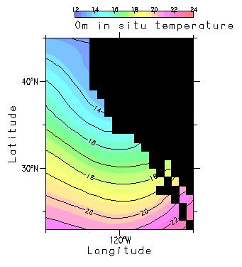
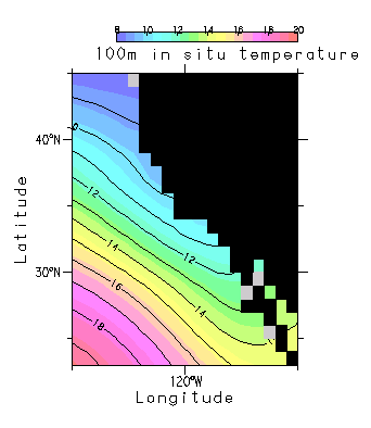
The California Current flows south along the west coast of North America, extending from the Columbia River to central Baja California. (MacCall, 1986). The California current is a classic eastern ocean coastal upwelling system with a narrow to moderate continental shelf and generally broad, diffuse, equatorward surface flow. (Wooster and Reid, 1963; Parrish et al., 1983) The California Current forms the eastern limb of the North Pacific Subtropical Gyre, flowing equatorward off the western United States and northern Mexico, exhibiting a mixture of filaments, mesoscale eddies, and counterflows. Wind-driven surface Ekman transport away from the coast is superimposed on the geostrophic current, resulting in upwelling centered near Cape Mendocino in northern California and off Baja California (Punta Baja) during the spring and summer. (Reid et al., 1958; Bakun, 1993; Bakun and Nelson, 1977) Major eddies occur in the warmer Southern Califorina Bight (SCB) south of Point Concepcion, which is influenced by islands, and in Sebastian Viczaino Bay, Baja, California. (MacCall, 1986) (http://www.na.nmfs.gov/lme/text/lme3.htm) |